Want to buy or sell something? Check the classifieds
  • The Fedora Lounge is supported in part by commission earning affiliate links sitewide. Please support us by using them. You may learn more here.

google earth-style map of NYC, 1924 and 1951

Bustercat

A-List Customer
Messages
304
Location
Alameda
Click this link to explore:
http://gis.nyc.gov/doitt/nycitymap/
Too cool, hours of fun.

Screenshots of some goodies, shamelessly lifted from here.
4314021077_5e3b9f8132_b.jpg

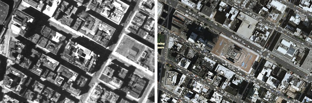
Empire state building, before and after

4314018465_9467b2849b_b.jpg

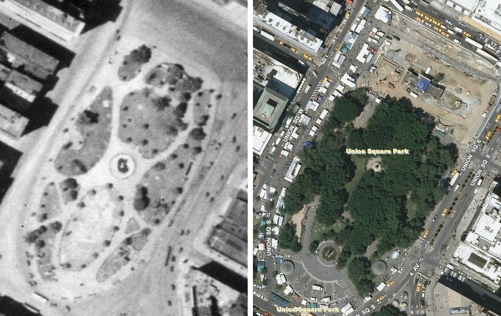
Union square park. Where's the shade?

4314014001_de177c340f_b.jpg

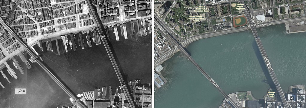
Look at all the shipping between the brooklyn and manhattan bridges!

4314020323_157be5bee6_b.jpg

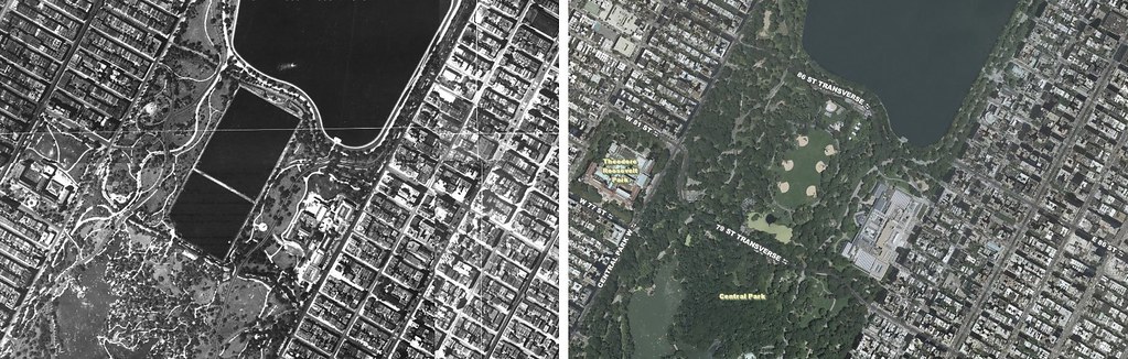
Central park was wetter...
 

Bustercat

A-List Customer
Messages
304
Location
Alameda
Cheers!

If you know the east midtown area, you might be interested in the bottom link on this thread:
http://thefedoralounge.com/showthread.php?t=50943
It's Charles Sweeney, an old firefighter talking about what the area was like in the 20s and 30s. I've been using the map to follow along. Everything from stickball and dances at tammany hall to irish tough guys and noodle factories. Very cool stuff.
It was the site of the biggest population movement in NY history when they built stuytown for WWII vet families.
 

Forum statistics

Threads
107,325
Messages
3,034,119
Members
52,776
Latest member
HughGDePoo
Top